Friday 26 July 2013

Prince Rupert Wall Murals

Prince Rupert has some amazingly beautiful (and large!) wall murals. There are apparently about 10 of them in the downtown area. We didn't see them all and some are difficult to get clear photos of without other buildings or wires in the way. All of these were done by wildlife artist Jeff King from Nanaimo. Obviously a very talented man!

Eagle mural on the Crest Hotel (darn building in the way of a decent photo!)
Rona building - mural wraps around the left side of the building
(wires in the way of a decent photo!)


There's also some really nice parks in & around the city and a colourful sunken garden behind the courthouse. 

At the sunken garden
See Andrew's blog for more photos at the sunken gardens.

One of the views along the Butze Rapids Trail

A favourite spot on the drive to Prince Rupert was the ancient forest (now a protected area), just east of Prince George.


See Andrew's blog for more photos of the Ancient Forest. 


Thursday 25 July 2013

The Inside Passage

Fifteen hours on a ferry seems like a long time. But it was a very beautifully scenic 15 hours!

We took the ferry from Prince Rupert to Port Hardy via the Inside Passage. You're never out of sight of land as it's quite narrow in most places but the land drops off sharply into the water, reaching depths of more than 1,600 feet. Hence the ability for big boats to get through this passage.

Ethereal morning fog, mountains of trees, jagged rock, waterfalls, abandoned fishing villages, some active fishing and logging communities, sunshine, and eventually a colourful sunset . . . punctuated by several humpback whale sightings. A couple of the whales splashed around for several minutes which was very entertaining! Unfortunately, not close enough to get much for photos but luckily we had binoculars with us.


Our route and highlights of the route:


Tuesday 23 July 2013

Highlights of Haida Gwaii - Part 2

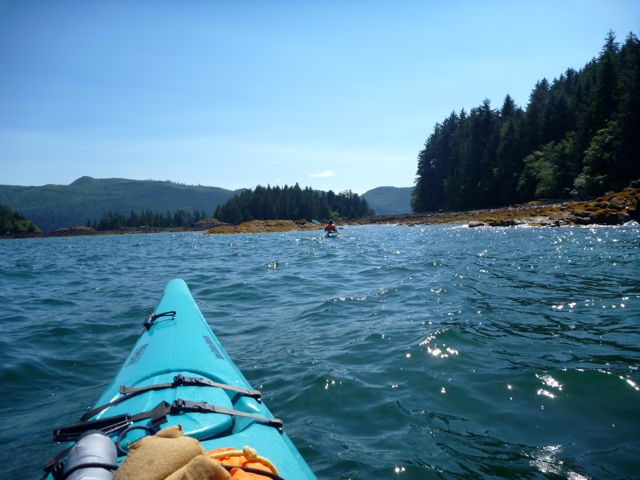
Eagles and many other birds and wildlife -- Eagles and Ravens were the most frequent birds that we saw. Suitably so since Haida people come from either the Eagle clan or the Raven clan. There were lots of other shore birds including sandhill cranes; we saw sea lions during our hike around Cape Fife and think we might have seen dolphins in the distance as well. There were lots of tiny deer along the highway between Skidegate and Masset. Andrew will have lots of great photos to post once he gets through them all!
Close
Closer
Closest
Great views and some ripe thimble berries!


Some really great coffee shops! 

Jags Beanstalk is just a mile from the ferry terminal in Skidegate. Great view of the ocean, home cooked breakfast and baking, wifi . . . what more could you ask for? Well, we did ask for more . . . a room for our last night (they have three rooms for rent over the coffee shop) but they booked us for the wrong day. They felt awful about it though and made several phone calls to find us another place. We were really not looking forward to a night in the tent when it was pouring rain!

The Grounds is located in Masset. Great coffee/tea, fresh made muffins and yummy (but sweet) granola bars. 

Moon Over Naikoon Bakery is located along a dirt road, not far from where we started our hike. We were coming out on a Sunday morning and saw a couple vehicles parked out front so thought we’d give it a try. We were a bit damp and cold from hiking through a bit of drizzle and this place was so welcoming, toasty warm, and fresh cinnamon buns were just out of the oven! And it does a booming business. The lady was making a second batch before we left! 
From the road, this is the only hint that there's a bakery nearby.
Bakery hidden in the trees just a few yards away! 

Monday 22 July 2013

Highlights of Haida Gwaii - Part 1


     Kayaking around the islands near Queen Charlotte City.


The Haida Heritage Centre in Skidegate – A large and very nicely done museum focused on the Haida culture. We happened to arrive shortly before the tour of the totem poles and the young Haida girl who led the tour was an excellent guide. 

The newest totem pole is near completion and will be raised in celebration of the 20th anniversary of the establishment of Gwaii Haanas, a park on Moresby Island. It was interesting to see one of the carvers at work. It takes three carvers about a year to do one pole. The other thing we found interesting is that the carving area is totally open and, as near as we could figure, has no security after hours. You would not see something like that in very many places!

Carving on the totem pole that is almost finished.
Two of six totem poles outside the Haida Heritage Centre.

Cape Fife Trail – The first part of the trail goes across inland from the west to east side of Naikoon Park. So much moss over fallen trees made it look like moss covered waterfalls. Beautiful!

We then hiked the beach to the northern tip of the park and back to where we started. The east side of the island in this area is uninhabited and we saw no one else, which was great! Unfortunately there is vehicle access on the west side so we saw a few trucks and ATV’s.

Although the entire length of the trail is only 35 km we stretched it out so that we could spend two nights camping on the beach. Note – if you’re doing this hike be aware there is no drinking water along the route despite a few streams being shown on the map. Luckily we took just enough to make do.


Waterfall-like moss
Funky design on the leaf
At the "tip" of the cape; simultaneous views of west and east beaches.
Walking on the beach was mostly pretty easy,
except when high tide forced us onto rocks that were like walking on marbles. 
Laying on the beach!
Exploring the beach from our campsite.


Tuesday 9 July 2013

Annoying or Humourous?

After Andrew's rant earlier this week about biking/walking trails in Saskatoon, I couldn't resist taking a couple photos this afternoon.

This is near the Lawson Civic Centre, cutting across from the cul de sac at the north end of Ravine Drive. This "unofficial path" has a ramp at the end. I have to admit, it looks like an unofficial ramp too. But the other end of this unofficial path has a ramp due to a now closed-off alleyway.


The "official" path does not have a ramp at either end. I mean, really . . . It's not like anyone who rides a bike, a parent with a child in a stroller, or someone confined to a wheelchair would want to use this path anyway, right? So why bother making it easier or nicer for people?


These two paths run parallel and about 16 paces apart from each other. 

I can't decide if I should be annoyed or be humoured by this.